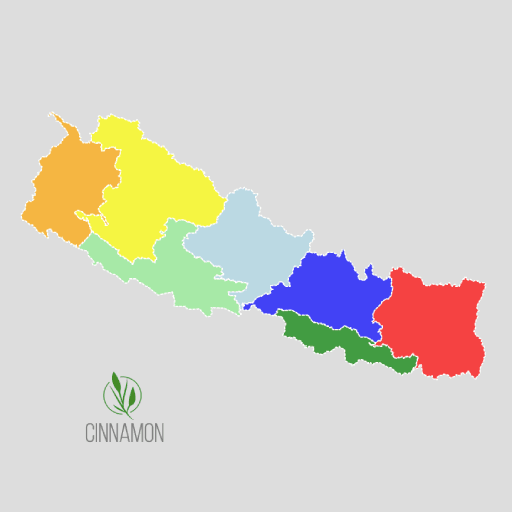
We are pleased to introduce a newly developed free web-based map of Nepal’s administrative boundaries, designed to serve planners, researchers, developers, and anyone in need of accurate geographical and population data. This interactive platform provides easy access to all administrative levels, including provinces, districts, municipalities, and ward-level boundaries, making it a one-stop destination for reliable spatial information.
The website also includes the latest ward-level population data from the 2021 census, integrated directly into the map. Users can explore population figures alongside geographic boundaries, making it a valuable tool for demographic studies, development planning, GIS analysis, or educational purposes.
The website features a user-friendly interface that allows users to freely download data in KML formats with just a single click without any registration or payment required. Whether you’re working on a professional GIS project or simply interested in exploring Nepal’s administrative landscape, this platform provides a convenient and authoritative resource.
We encourage everyone to visit the website and take advantage of this open-access map. It’s an excellent tool for anyone seeking a detailed, accurate, and up-to-date administrative map of Nepal.